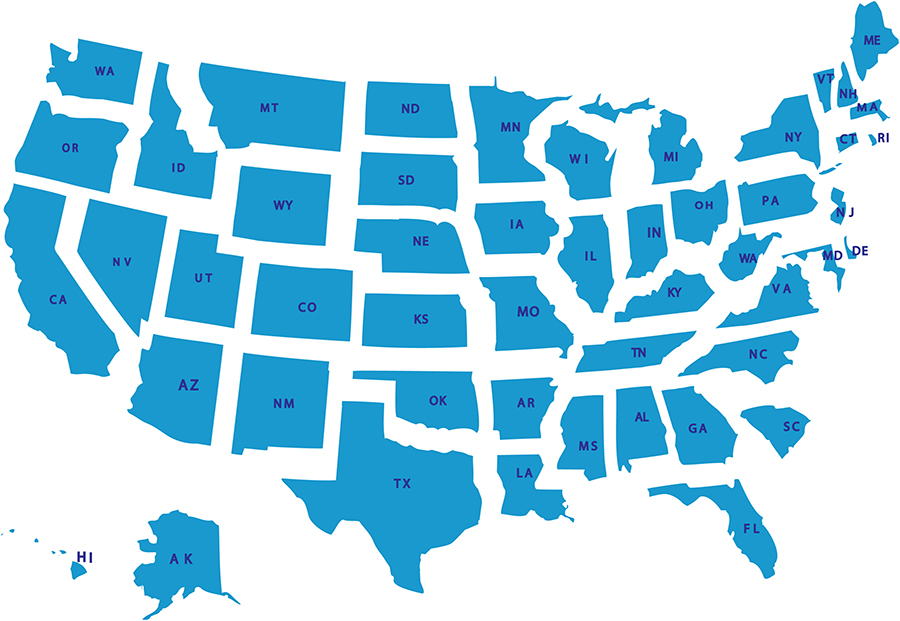
How the Shapes of US States Evolved
# Origins of State Boundaries
The boundaries of the original 13 colonies were largely influenced by colonial charters drawn up by the British crown, with little regard to things like terrain or watersheds. Colonies were awarded to private companies and individuals as a way to encourage exploration and settlement. Over time, colonists pushed the boundaries further from the coastal regions inland. northeast colonial charters absolute border After the American Revolution, the new Congress took on the task of organizing the vast western lands into coherent territories and future states. Led by Thomas Jefferson, they established the concept of the rectangular survey system - imposing a rational grid of north-south and east-west lines regardless of natural features. This helped establish a principle of states having roughly equal land area and made administration and sale of public lands more orderly.
# Natural Features Versus the Grid
In the original 13 colonies and other long-settled regions like the Midwest, state borders follow rivers like the Ohio and waterways that served as the key transportation corridors of the day. In Appalachia, the mountain spine helped delineate borders between states like Tennessee and North Carolina. However, as the nation expanded westward in the early 19th century, the rectangular survey increasingly took precedence over following terrain. With vast open landscapes, drawing boundaries along arbitrary north-south lines proved simpler than negotiating every twist and turn of a river valley. This trend is most visible in the evenly gridded states of the Great Plains like Colorado and Wyoming.
# Railroads Reshape the Map
As the new technology of railroads emerged in the mid-1800s, they began to reshape state boundaries from their original riverine contours. Rail lines forged straight shots across states, disregarding watersheds. Border towns grew up along tracks rather than waterways, pulling borders towards railroad corridors. States in the Midwest like Indiana had their territories adjusted to line up with new east-west rail routes.
# Slavery’s Impact on Boundaries
The issue of slavery complicated state boundary decisions, especially regarding newly acquired western lands. To balance the number of slave versus free states, compacts like the Missouri Compromise deliberately adjusted the boundaries of states. The 36°30′ parallel bisected Missouri, establishing a line between slaveholding Kentucky and free Illinois that still exists today. Later agreements prevented slavery in Utah and the Dakota Territory by making their northern borders follow the latitude lines.
# Accommodating Fait Accompli States
Some states like California and Texas essentially defined their own boundaries, forcing Congress to accept borders that did not always follow the usual patterns. Both had been foreign territories - Mexican states that joined the union with large expanses of land. Congress accommodated these fait accompli states rather than break them up into smaller units. This created some exceptional, illogically shaped states in the process.
Natural Features Prevail in the East
In the original 13 colonies clustered along the Eastern Seaboard, the boundaries continue to be defined by rivers, bays and other natural divides. This reflects their long histories of settlement patterns before the era of the rectangular survey. States in this region like Maryland are shaped by following the meandering paths of waterways rather than imposing grids. The complex coastlines of states like Maine are still molded by the nooks and crannies of the irregular New England shoreline as well.
Prairie Grids West of the Mississippi
By contrast, the states carved out of the vast plains stretching west from the Great Lakes to the Rockies exhibit the ascendance of the systematic survey lines. Grid-like borders dividing Nebraska, Kansas, the Dakotas and other Midwestern states reflect use of easy-to-administer north-south and east-west boundaries. The prairies offered few natural features worth following, making the rational Cartesian grid all the more sensible in dividing up the empty Great Plains.
Mountain Borders Defined by Topography
In the rugged mountain west, state boundaries again take their cues from prominent physical features like mountain ranges and peaks. Idaho shares long borders with mountainous Montana and Wyoming defined by the towering Bitterroot, Beaverhead and Rocky Mountain ranges. Colorado’s boundary with Utah likewise traces the high Continental Divide for hundreds of miles. These natural borders in the west reflect its origins as sparsely settled frontier land.
Hawaii - An Archipelago Apart
As the only state comprised of islands separated from the other 49, Hawaii has no contiguous land boundaries whatsoever. Its unusual form reflects its geographical isolation in the mid-Pacific, far removed from North America. The islands’ jurisdictions are defined solely by ocean waters rather than continental terrain features or survey lines. Hawaii remains a singular case among the norms established for defining state boundary lines on the North American mainland.
In conclusion, the boundaries between the 50 United States reflect the varied factors that shaped America’s expansion across the continent - from British colonial charters to railroads, and compromises over slavery. States in long-settled eastern regions retained erratic, terrain-following borders while the vacant West saw rational grids imposed. Throughout it all runs the tension between natural divides and people’s drive to partition the land in orderly, administrable ways.